Our Experienced Staff
Key Personnel / Resumes
Our firm consists of a total of sixteen professional and technical personnel, which provides sufficient staff to perform projects that may arise within schedule. Johnson-Frank & Associates, Inc. maintains a highly professional staff. We are proud of the fact that 4 of our 10 office staff and two of our Survey Party Chiefs are registered to practice land surveying in the State of California. Below is a summary of the experience, training, and skills of our professional staff.
- Roger A. Frank, PLS: Principal, Director of Map Checking
- Licensed in California, Nevada, Utah, Wyoming, New Mexico, North Dakota, and South Dakota
- Certified Federal Surveyor #1092
- 49 years of experience in public and private sectors
- 39 years with Johnson-Frank & Associates
- Alan D. Frank, PLS: Principal, Project Surveyor / Map Check Supervisor
- Licensed in California, Nevada, and Arizona
- Certified Federal Surveyor #1091
- 24 years of surveying experience
- 24 years with Johnson-Frank & Associates
- Bachelor of Science degree in Surveying Engineering, CSU Fresno
- Masters degree in Business Administration, CSU Fullerton
- Iris Warfield, Map Check Analyst
- 24 years surveying experience
- 24 years with Johnson-Frank & Associates
- Joseph Padilla, PLS: Project Surveyor
- Licensed in California since 1999 - PLS 7557
- 37 years of surveying experience
- Rich Smith, PLS: Survey Party Chief
- Licensed in California
- Certified Federal Surveyor #1506
- 24 years of surveying experience


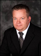
Alan D. Frank, PLS

Mr. Frank has a Bachelor of Science Degree in Surveying Engineering obtained from the California State University in Fresno and a Masters Degree in Business Administration obtained from the California State University in Fullerton. He has been licensed as a Professional Land Surveyor in the State of California since 1995, the State of Arizona since 2004, the State of Nevada since 2008, and became a Certified Federal Surveyor in 2007. He has over 28 years experience in the surveying industry.
Project Specific Experience Includes:
Supervisor of Subdivision Map Checking Section
Mr. Frank supervises the full time map checking staff at Johnson-Frank in their review of Final Maps (Tract Maps), Parcel Maps, Amended Final Maps, Record of Surveys, Lot Line Adjustments, Certificates of Compliance, Certificates of Correction and Legal Descriptions and Plats for numerous Cities and Counties, including the Cities Irvine, Mission Viejo, Laguna Niguel, San Marino, and Covina, as well as the County of Orange.
Subdivision and Parcel Consolidation of Anaheim Stadium Properties
CIty of Anaheim
This project involved conducting boundary and topographic surveys, encroachment analysis, and writing new legal descriptions, as well as the preparation and recordation of a Parcel Map to facilitate development of portions of said property. Mr. Frank served as the Project Manager for this project, which was completed in 2008 at a cost of approximately $160,000.
IDIQ Contract for Surveying and Mapping
Los Angeles District, US Army Corps of Engineers
Project and Contract Manager for various surveying tasks including topographic surveys, boundary retracement, legal description preparation, hydrographic surveys, and related GIS services. A total of 48 task orders were issued, totaling just over $5,000,000.
On-Call Surveying Services
Port of Long Beach, California
Projects performed for the Port of Long Beach have included the re-observation and establishment of the Port wide Geodetic Control Network, general T&M personnel and crew services, Laser Scanning Topography, Conventional Topographic Surveys, Underground Utility Delineation (DigAlert), and various Construction Staking projects throughout the Port. Mr. Frank serves as the project manager for this project.
Structure Location and Positioning throughout LA, Orange, San Bernardino, Riverside, and San Diego Counties, Metropolitan Water District of Southern California
This project involved the positioning of 4,912 structures throughout Southern California. In order to meet the tight project deadline, we employed as many as 4 real time network GPS positioning crews at a time. The project was completed on time and within budget. Mr. Frank served as the project manager for this project. This project was completed in 2007.
Roger A. Frank, PLS

Roger Frank, President and CEO, co-founded the present day corporation of Johnson-Frank & Assoc., Inc., in 1975. His grasp of the future direction of the profession, as well as the impact of rapidly changing technology on the role of the surveyor, was the primary reason for the company to be the first firm of its' size in southern California to embrace Global Positioning Satellite systems in 1988.
Mr. Frank's 51 years of experience includes eleven years of training both in the office and in the field at the Orange County Surveyor's Office. A licensed professional surveyor in seven western states, as well as a Certified Federal Surveyor, Mr. Frank has expertise in boundary surveys; precise horizontal and vertical control surveys; photogrammetric control surveys; aerial mapping control; cadastral retracement; ALTA's; section line retracement; all elements of Global Positioning Systems surveys, legal descriptions as well as an in-depth knowledge of subdivision map review skills.
Mr. Frank's early training was with the Orange County Surveyor's Office in both the field and the office. He developed a keen interest and in-depth experience in geodetic horizontal and vertical surveys while with the Orange County Surveyor's Field & Office Computation section. He also served in the Subdivision Map Checking section for his last six years with the County, the last three of those Mr. Frank served as supervisor of that section. He developed vast boundary and subdivision experience while in this position. He also supervises and trains Johnson-Frank's Subdivision Map Checking section, which currently serves 7 local cities.
Roger Frank's leadership at the helm of the organization has guided it through the highs and lows of economic climates. Always innovative, yet strongly committed to product integrity, he oversees the key strategy and execution of assignments for Johnson-Frank & Assoc., Inc., including survey projects in 35 states.
Project Specific Experience Includes:
Colorado River Aqueduct (CRA) Desert Surveys, Metropolitan Water District of Southern California
The CRA program involved extensive cadastral retracement throughout California's deserts from Parker, AZ to Corona, CA, and from Blythe, CA to Hoover Dam. Mr. Frank served as the project manager for the Desert CRA tasks under this contract. This project was completed in 2007.
March Air Reserve Base, Moreno Valley, CA
US Army Corps of Engineers, LA District
This project involved establishing the original boundary lines of the March Air Reserve Base and assisting staff with documenting and preparing legal descriptions in support of the BRAC process which included disposing of excess land. Mr. Frank served as the project manager on this project. This project was completed in 2007.
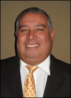
Joseph Padilla, PLS

Mr. Padilla began his surveying career in 1981 and brings extensive experience and knowledge to the Johnson-Frank Team. He was employed until 1983 when he went back to Fullerton College as a full time student. After completing and receiving his certificate in computer programming Mr. Padilla returned to JM Negrete & Associates in April of 1984. Mr. Padilla worked in both the field and office with a heavy emphasis on boundary, and topographic surveys as well as Final Maps, Parcel Maps and Condominium Diagrammatic Plans.
In April of 1990 Mr. Padilla joined the offices of Pafford and Associates in Los Angeles, CA. Major projects during his employment at Pafford include the conversion of substructure utility plans at Disney Studios in Burbank, CA to CAD format, the CAD plans for substructures at Sony Studios in Culver City, CA, the precise building layout calculations for the Southern California Gas Company high-rise building in downtown L.A.
In 1993 Mr. Padilla was employed by Coast Surveying in Tustin, CA. His first assignment was as a consultant to the Orange County Surveyor’s Office reviewing the calculations for required tolerance of maps for the County’s new Geographical Information System. The original 9 month contract was extended another 6 months. After the completion of the contract Mr. Padilla was assigned to support the survey crews with layout and grading calculations for the construction of the 241 Toll Road and drafting the railroad crossing in Orange County for the Metro Rail Project.
In October of 1998 Mr. Padilla joined the offices of Guida Surveying, Inc., in less than 2 years Guida Surveying doubled in size due to the securing of a contract to survey Telecommunication Cellular Sites by Mr. Padilla. By 2005 Guida Surveying grew to 4 offices in California and Mr. Padilla was promoted to Director of Operations for the Corporate Office in Irvine, CA. Mr. Padilla’s responsibilities included the day to day operations of the company, meeting with clients and prospective new clients, writing proposals for projects and reviewing work of subordinates working under his direction.
In February of 2008 Mr. Padilla left Guida Surveying, Inc. to open his own surveying firm. His company performed construction staking surveying, boundary, topographical, Parcel Maps, Tract Maps, Record of Surveys and ALTA Surveys as well as surveys for telecommunication providers.
In April of 2018 Mr. Padilla joined Johnson-Frank & Assoc., Inc. as a Project Surveyor and Survey Project Manager. He currently manages various survey projects throughout the Southwest.
